What to See at Fire Island
A barrier-island national seashore an hour from New York City, and a whole world apart.
Fire Island is a long, skinny barrier island off the south shore of Long Island, and the National Park Service protects a 26-mile stretch of it. The big thing to know upfront: most of it is car-free. You reach it by ferry, water taxi, or your own boat, and once you're there you walk. That's a feature, not a bug. It's why the beaches feel quiet and the night sky still has stars.
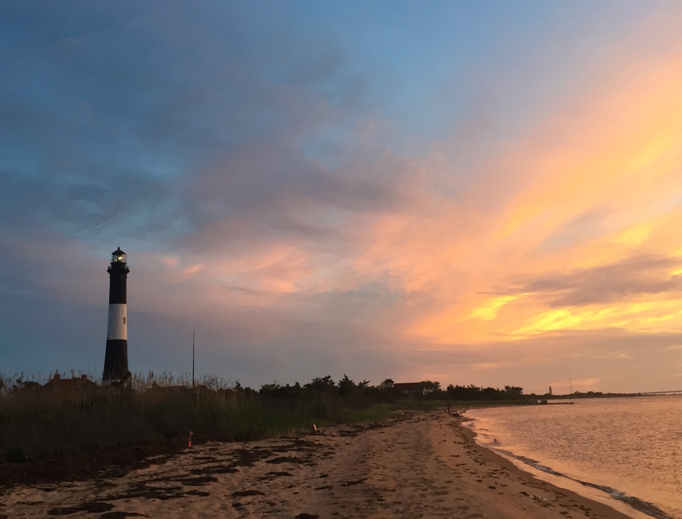
The Fire Island Lighthouse
If you only see one thing, see this. The black-and-white tower has guarded the Great South Bay since 1858, and it's the most accessible NPS site on the island, reachable by car via Robert Moses State Park, then a flat three-quarter-mile boardwalk and beach walk to the base. The "Tour the Tower!" climb takes you up 182 steps to the lantern room, where the view stretches from the Manhattan skyline to the open Atlantic. There's a visitor center in the old keeper's quarters with the original Fresnel lens. Good for kids, good for grandparents who'll wait at the bottom.
The Sunken Forest
At Sailors Haven you'll find one of the rarest things on the East Coast: a 350-plus-year-old maritime holly forest growing in the hollow behind the primary dune. A boardwalk loop winds through gnarled holly, sassafras, and shadblow, all of it pruned flat by salt spray so the canopy sits below the dune line. The contrast (dense green forest one minute, open ocean from the overlook the next) is the reason to come. It's a roughly 1.5-mile loop, mostly shaded, easy for most legs. Sailors Haven is ferry-only from Sayville.
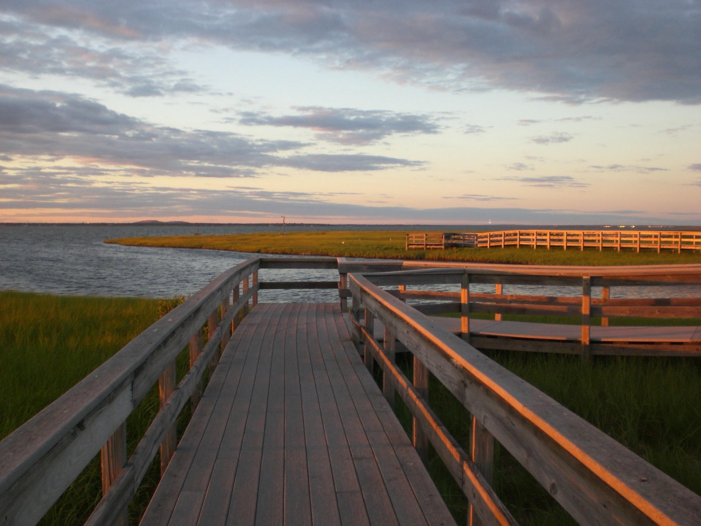
Watch Hill and the Otis Pike Wilderness
Watch Hill is the seashore's most developed end, with a marina, a seasonal snack bar, a campground, and a boardwalk salt-marsh trail that's genuinely lovely at golden hour. It's also the western gateway to the Otis Pike Fire Island High Dune Wilderness, the only federally designated wilderness in the state of New York. From here you can pick up the Burma Trail, a seven-mile backdune footpath running east to Smith Point. One note: the NPS recommends hiking it in cooler months because summer mosquitoes are brutal, and ticks are present year-round. Do a tick check after. In warm weather, walking the ocean beach beside the wilderness is the saner option.
Things to do once you're out there
- Birding at Fire Island: the island sits on the Atlantic Flyway, so spring and fall migrations are excellent. Watch for piping plovers (and respect the seasonal closures that protect them).
- Fishing Fire Island: surfcasting from the wilderness beach for striped bass and bluefish is a local tradition.
- Boating Fire Island: much of the access here is by water, and the Great South Bay is the heart of it; the marinas at Watch Hill and Sailors Haven take transient boaters.
- Backcountry Camping in the Otis Pike Wilderness: permit-required, primitive, and a real solitude payoff for prepared backpackers.
- The William Floyd Estate: on the Long Island mainland in Mastic Beach, the home of a Declaration signer, open seasonally with the historic Old Mastic House and grounds. An easy add-on, no ferry needed.
How to actually get there
This is where families trip up, so plan it before you go. The Lighthouse end connects by car through Robert Moses State Park (Field 5). Sailors Haven (Sunken Forest) and Watch Hill are ferry-only, leaving from Sayville and Patchogue respectively. Check the seasonal schedule and buy a round trip. Both of those ferry docks have parking lots on the mainland. The Wilderness Visitor Center at Smith Point is reachable by car via the William Floyd Parkway. There are no roads connecting the communities to each other, so pick your destination first and route to its specific access point. Bring water, sunscreen, and bug spray; shade is scarce away from the Sunken Forest.
Planning the trip? Nestward builds a day-by-day plan in minutes, free, no subscription. See how it works →