What to See at Curecanti National Recreation Area
The water, the spires, and the canyon: Colorado's underrated big-water park.
Curecanti is three reservoirs strung through western Colorado along U.S. Highway 50, a landscape where dams, sagebrush, and a deep volcanic canyon all share the same view. Most people blow past it on the drive to Black Canyon of the Gunnison next door, which is exactly why it stays uncrowded. Come for the boating and the scenery; stay because nobody else is here.
Blue Mesa Reservoir and the Dillon Pinnacles
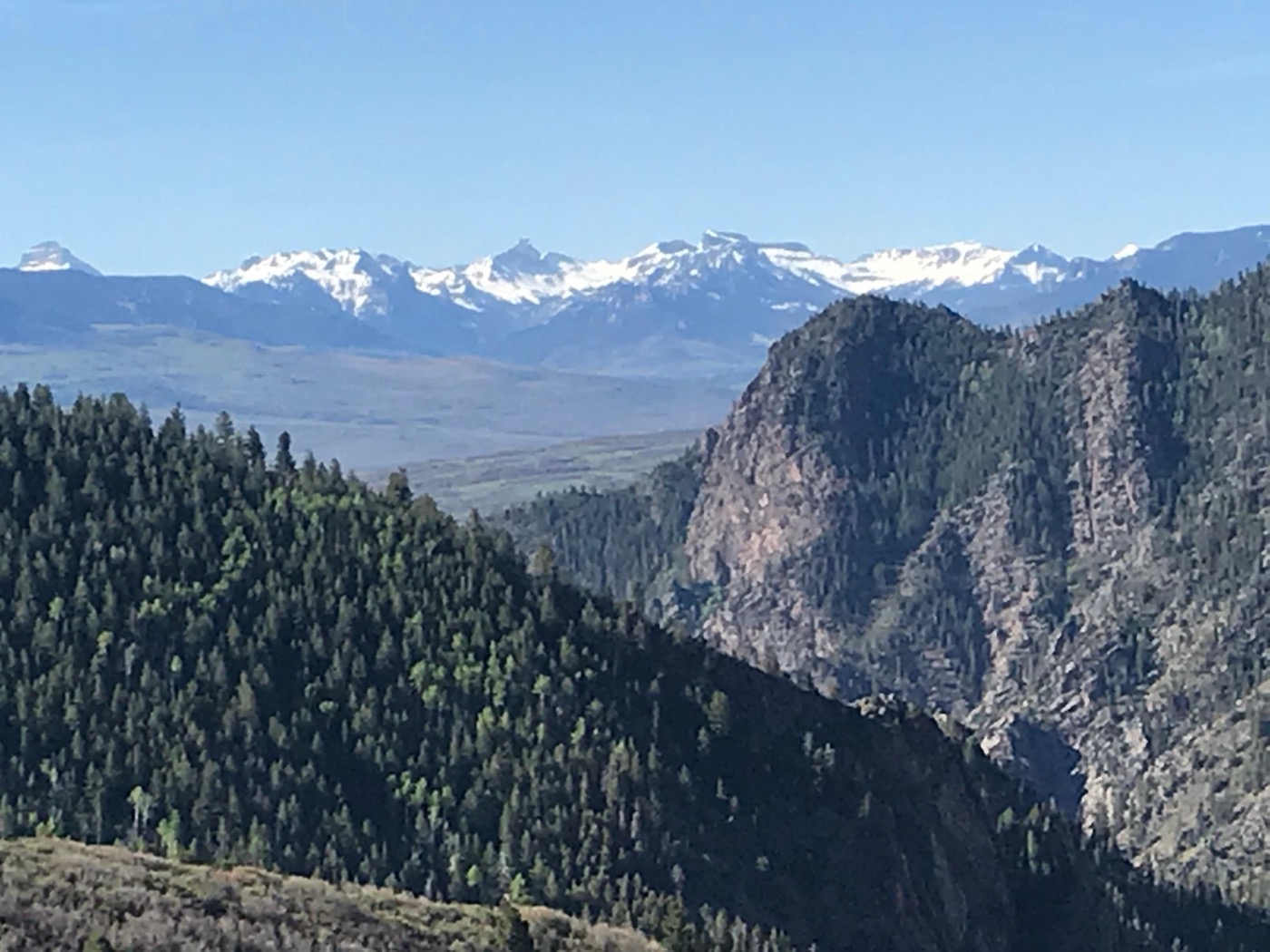
Blue Mesa is the largest body of water in Colorado, and it's the heart of the park. You'll see it the moment you turn onto Highway 50: bright blue water folded between dry, sage-covered hills. It's the spot for boating, sailing, paddleboarding, and freshwater fishing, with marinas and ramps for getting on the water.
The signature land view is the Dillon Pinnacles: a row of volcanic spires standing over the reservoir's north shore. There's a trail out to a viewpoint, and even if you don't hike it, the pullouts along Highway 50 give you the postcard. If you do one short walk at Curecanti, make it this one: it's the clearest payoff for the least effort.
Morrow Point and the boat tour
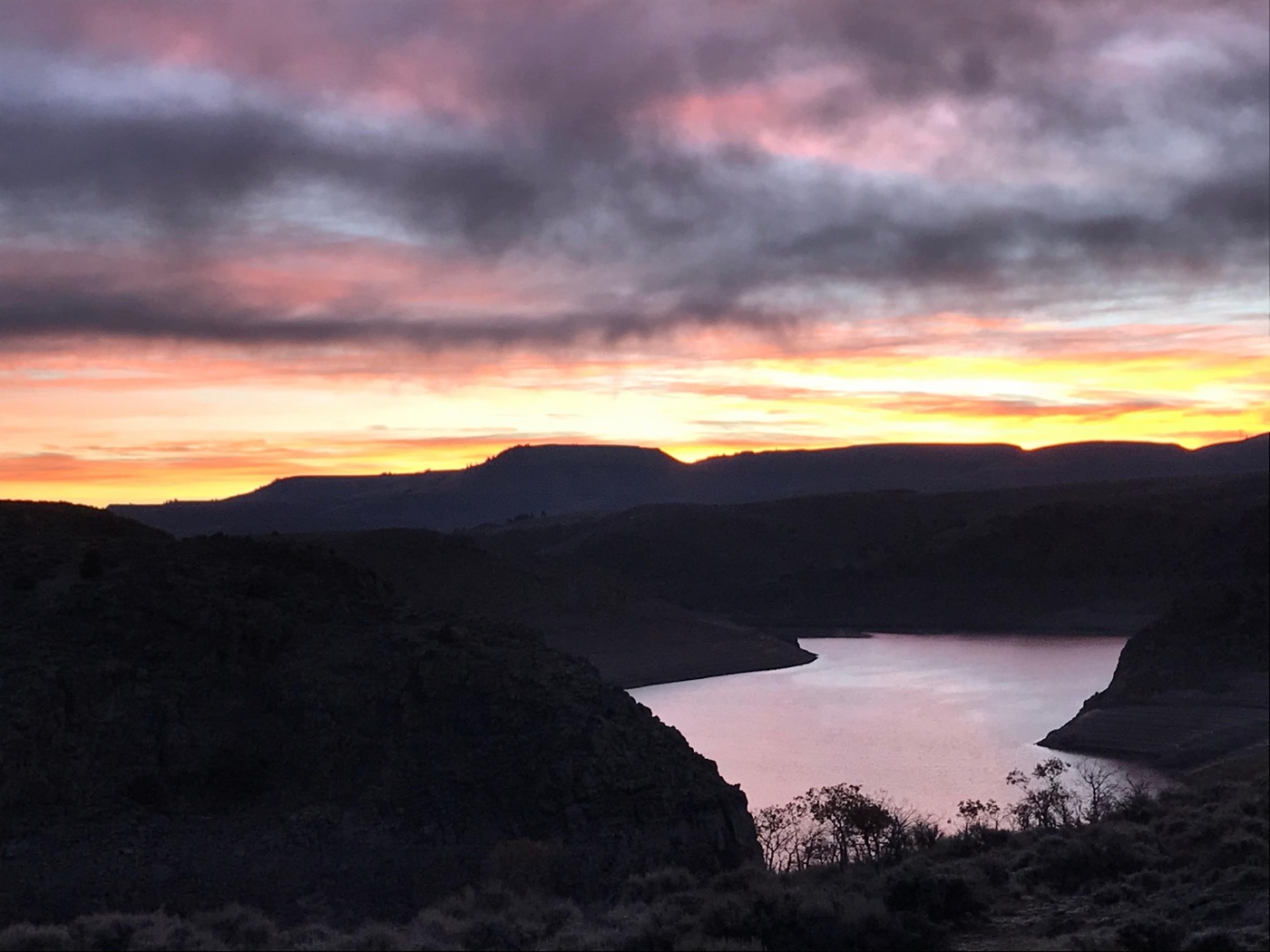
Below Blue Mesa, the canyon tightens dramatically into Morrow Point Reservoir, narrow water between steep walls and spires and the upper end of the Black Canyon by another name. This is the most spectacular scenery in the park, and the easiest way to reach it is by water.
The classic route in is the Pine Creek Trail, which follows an old narrow-gauge railroad bed down to the reservoir along the canyon. The descent uses maintained steps, so it's moderately strenuous and not wheelchair accessible. Fine for most families, but budget the climb back out. The NPS has historically run a ranger-narrated boat tour on Morrow Point; if it's operating during your visit, it's the best seat in the house. Check current status with the park before you count on it, since dates and reservations change year to year.
Hikes worth your legs
Curecanti's trails are short, scrappy, and often empty. A few real ones from the park's own list:
- Pine Creek Trail: the railroad-bed descent to Morrow Point Reservoir; the marquee hike.
- Curecanti Creek Trail: a steeper drop into the canyon, rewarded with up-close pinnacle views.
- Hermit's Rest Trail: a longer, knee-testing descent to the water with big canyon scenery.
- Neversink Trail: flat, easy, and good for birdwatching along the Gunnison River; the kid-friendly pick.
- Mesa Creek Trail: a short, mellow walk near Crystal Reservoir.
Note the pattern: the dramatic ones go down into the canyon, which means the workout is on the return. Carry more water than you think you need. Afternoons are dry and the wind tends to pick up around midday.
Scenic drives and the rest of the water
You can see a lot of Curecanti from the car. U.S. Highway 50 runs the entire length of the park east to west and strings together the big overlooks. For the dramatic version, CO Highway 92 climbs the north rim with long views down into the canyon and reservoirs. And East Portal Road drops steeply to the Gunnison River at the bottom, a great short detour, though it's narrow and not for large RVs or trailers.
Past Blue Mesa, Crystal Reservoir is the smallest and quietest of the three, good for paddling and fishing without a crowd. Anglers come to Curecanti for the Gunnison River and the reservoirs year-round; this is a fishing destination as much as a sightseeing one.
Don't skip the night sky
Curecanti sits far from city light, and the park leans into it with stargazing and astronomy. On a clear, moonless night the Milky Way arcs right over Blue Mesa. If you're camping (there are front-country and RV sites here), just walk away from the lights after dark and look up. It costs nothing and it's one of the best things the park does.
Planning the trip? Nestward builds a day-by-day plan in minutes, free, no subscription. See how it works →