What to See at Cape Hatteras National Seashore
North Carolina's wild Outer Banks: lighthouses, open beaches, and water on both sides.
Cape Hatteras isn't a single overlook you drive up to and tick off. It's roughly 70 miles of barrier island strung along NC-12, with the Atlantic on one side and the calm sounds on the other. The headline sights are three lighthouses and a lot of empty beach, but the real draw is how much room there is to spread out.
The three lighthouses
Lighthouses are the thing here, and there are three of them. They make a natural spine for a road trip up or down the islands.
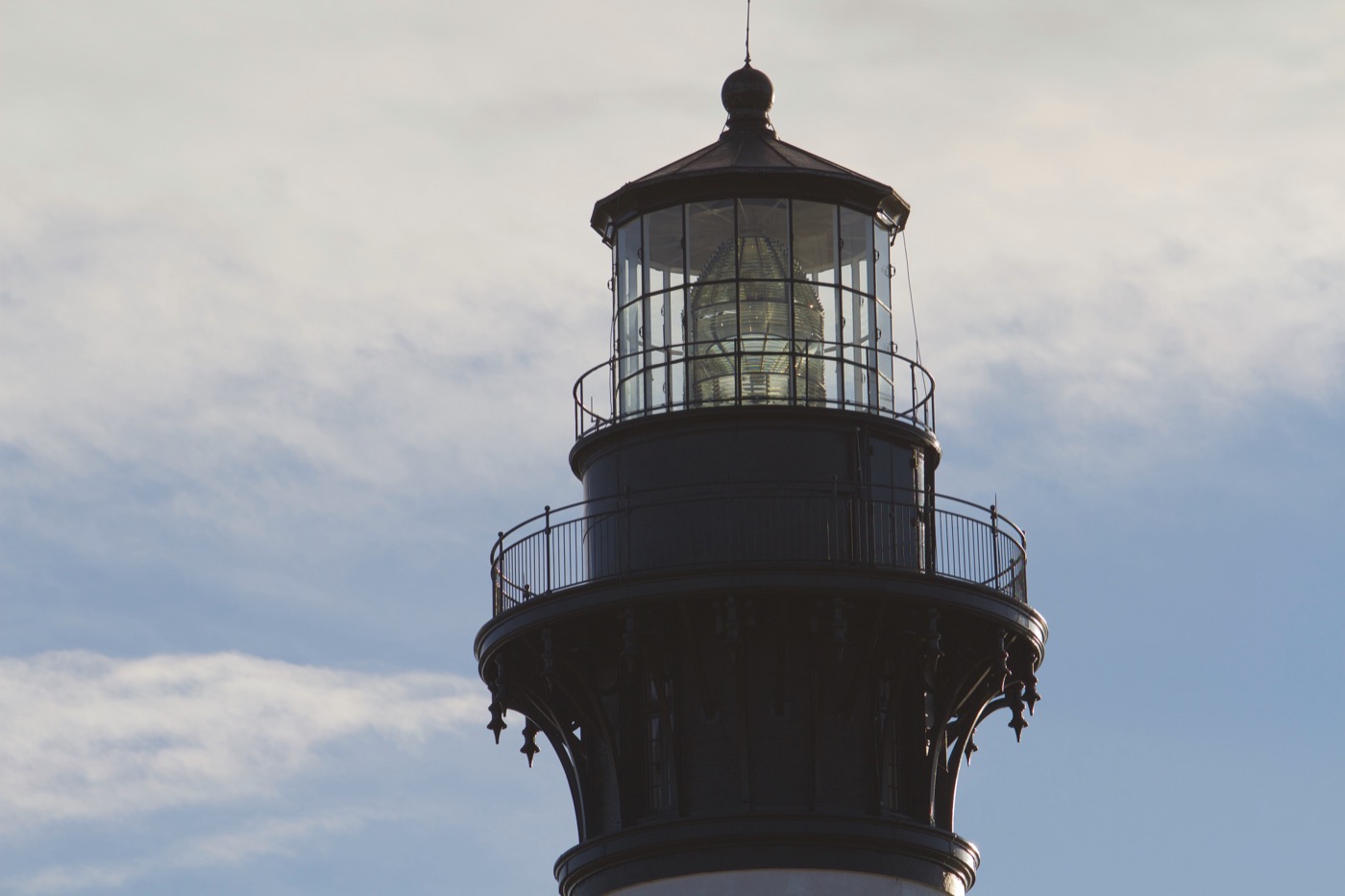
- Cape Hatteras Lighthouse (Buxton): the tall black-and-white spiral one, the tallest brick lighthouse in the country. Famously moved 2,900 feet inland in 1999 to escape the eroding shore. You can usually climb it in season for a wide view, but it goes through long restoration closures, so check the current status before you build a day around the climb.
- Bodie Island Lighthouse (near the north end): horizontal black-and-white bands, and it still holds its original first-order Fresnel lens. There's a short boardwalk through the marsh nearby that's easy with kids and good for birds.
- Ocracoke Lighthouse: the small, solid-white one on Ocracoke Island. You can't climb it, but it's the oldest still operating in North Carolina and worth the walk over.
The beaches and the water
This is the part people underestimate. The seashore protects long stretches of undeveloped Atlantic beach, and because access is spread across many ramps and parking areas, it rarely feels packed once you're past the obvious spots. Swimming, surfing, and shelling are all on the menu, and the lifeguarded beaches near the villages are the safe bet for families.
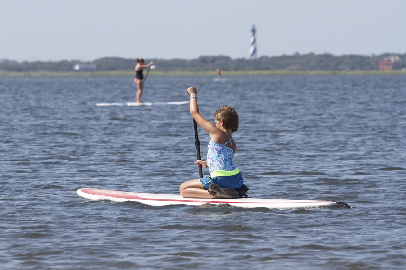
Don't ignore the sound side. The Pamlico Sound behind the islands is shallow, warm, and protected, ideal for kayaking, paddleboarding, and letting small kids wade without worrying about Atlantic surf. The NPS specifically points to the sound for calmer recreation. A flat morning on the sound with the lighthouse in the distance is one of the easiest good days you can have here.
Wildlife and the night sky
The barrier islands are a serious birding spot, especially in migration, and the marsh boardwalks make it accessible without any real hiking. Sea turtles nest on these beaches in summer, which is why you'll see roped-off dune sections. Give them a wide berth. You may also share the sand with shorebirds nesting in spring and early summer; those closures are temporary and well-signed.
After dark, look up. Away from mainland light, Cape Hatteras has genuinely dark skies, and stargazing is one of the quiet highlights nobody puts on the brochure. Bring a blanket and walk out past the dune line.
Getting around and a few practical notes
Everything strings along NC-12. From the north you reach the seashore via US-158 to Nags Head, then south on NC-12. The southern end (Ocracoke Island) is reachable only by NCDOT ferry, including longer routes from Cedar Island and Swanquarter. Build the ferry schedule into your plan; it's part of the trip, not a detour around it.
- The park grounds are open all day, year-round, and there's no entrance fee. Lighthouse climbs and the visitor centers are the parts with hours and seasons.
- Weather on the Outer Banks shifts fast, and this is hurricane-prone coast in late summer and fall. Check the forecast the morning of, not the week before.
- Four-wheel-drive beach driving is allowed in marked areas with a permit, fun if you're set up for it, skippable if you're not.
- Distances are deceiving. Buxton to Ocracoke village looks short on a map but includes a ferry. Plan one or two villages per day rather than trying to see all three lighthouses in a single push.
Planning the trip? Nestward builds a day-by-day plan in minutes, free, no subscription. See how it works →