The Best Easy Hikes in Bryce Canyon
Short trails, real distances, and how to pace them at 8,000 feet.
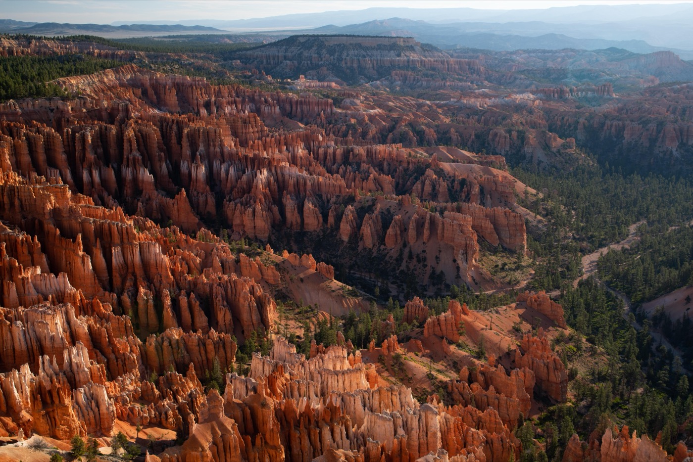
Bryce Canyon has the largest concentration of hoodoos (those irregular rock columns) found anywhere on Earth, and the good news is you don't need a hard hike to stand among them. The catch is the elevation: the rim sits near 8,000 feet, so "easy" here means short and scenic, not effortless. Here are the trails worth your time, with real distances and what the climb back actually feels like.
Queen's Garden: the gentlest way below the rim
If you do one hike in Bryce, make it Queen's Garden. Starting from Sunrise Point, it's about 1.8 miles round trip and drops you straight into the amphitheater, close enough to touch the hoodoos instead of just photographing them from above. The park itself calls it the least demanding trail that goes below the rim, and it shows: the grade is steady and forgiving on the way down.
The catch: what goes down must come up. You'll descend roughly 320 feet and earn every foot of it on the return, with thinner air than your lungs are used to. Budget 1 to 1.5 hours and don't race it.
The Rim Trail: views without the descent
Not everyone wants to drop into the canyon, and you don't have to. The Rim Trail runs along the edge of the Bryce Amphitheater, connecting the marquee viewpoints: Sunrise, Sunset, Inspiration, and Bryce Point. The stretch between Sunrise and Sunset Point is the flattest and most accessible, paved and only about a mile round trip.
- Sunrise to Sunset Point: ~1 mile round trip, mostly flat and paved. The easiest real walk in the park.
- Go further only if you want to: the trail continues toward Inspiration and Bryce Point, where it gets steeper and unpaved.
- Best light: the first three miles of the park road hold the iconic amphitheater views and they're a popular sunrise destination for a reason.
The Queen's/Navajo Combination Loop
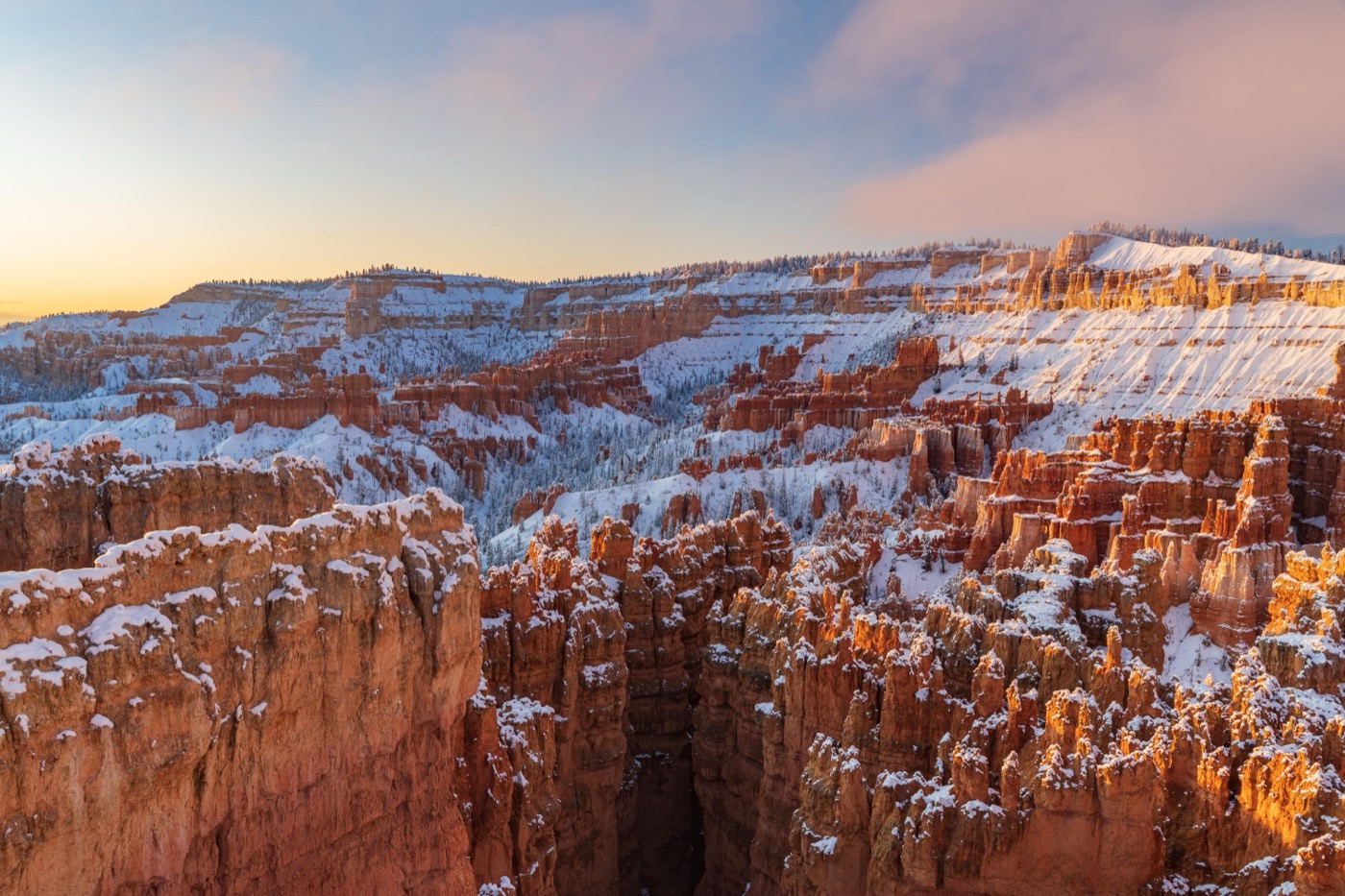
This is the park's classic, and it's usually billed as moderate rather than easy, but it's short enough (around 2.9 miles) that fit families with older kids tackle it all the time. You descend Queen's Garden, loop through the canyon floor, and climb back out via the Navajo Loop, passing Wall Street's tight switchbacks and towering walls. The Park Service rates the full Figure-8 Combination as the bigger version if you want more.
One logistics note worth knowing: the Wall Street side of Navajo Loop closes seasonally, often in winter and after storms, since snow and ice linger at this elevation well into spring. If it's closed, you climb out the Two Bridges side instead, still doable but with steeper switchbacks.
Bristlecone Loop: easy and high
Most visitors never leave the main amphitheater, which is exactly why the Bristlecone Loop is a quiet pleasure. It's about a 1-mile loop near Rainbow and Yovimpa Point at the southern, highest end of the park (roughly 9,100 feet), with views stretching over 100 miles on a clear day and ancient bristlecone pines along the way. It's nearly flat, but the altitude is real, so it'll still feel like more than a mile.
Pacing it with kids (and your lungs)
- Mind the altitude. At 8,000 feet, everyone tires faster and gets thirsty sooner. Bring more water than feels necessary and add sunscreen. The high-elevation sun is strong.
- Time your hike. Summer afternoons bring thunderstorms in July and August. Morning hikes are cooler, less crowded, and safer up high.
- Sunrise and Sunset Points are stroller-friendly along the paved rim. Once you go below the rim, leave the stroller behind.
- Grab a Junior Ranger booklet at the visitor center. It turns the rim walk into a scavenger hunt and buys you a slower, happier pace.
A word on dogs
If you're hoping to bring the dog, Bryce restricts pets to paved areas only: the campgrounds, the paved viewpoints, and the paved section of the Rim Trail between Sunrise and Sunset Point. Dogs are not allowed on any of the dirt trails below the rim, including Queen's Garden and Navajo Loop. It's a stricter policy than some parks but a common one, so plan a kennel or a willing non-hiker if you're traveling with a pup.
Planning the real thing? Nestward builds a day-by-day plan for this park in minutes, free with no subscription. See how it works →